Mappings
Document Contents
One of the main aims of this project is to reflect upon different 'mappings' of late-medieval Chester.
To explore this, two mapping exercises are currently in progress, one involving the creation of a map which shows Chester in around 1500, shortly before the time of the Reformation, and a second examining contemporary medieval texts that relate to the medieval city. These texts include the Middle English verse Life of St Werburgh by Henry Bradshaw (c. 1513), Lucian’s Latin De Laude Cestrie (In Praise of Chester) (c. 1195) and a selection of medieval Welsh poems which relate to Chester.
These two 'mappings' of medieval Chester are being undertaken by the different specialists that make up the project team as a whole. The geographers at Queen's University Belfast are working on the more 'literal' mapping exercise, while at Swansea the Department of English team are working on medieval 'literary' mappings of Chester. The idea is that we use these individual exercises to begin to explore how different kinds of 'mappings' relate to each other; both methodologically, as two accepted approaches used in understanding the medieval city, and conceptually, as expressions and representations of medieval Chester's constitutive urban spaces.
The two 'mappings' are currently at an early stage, but to give a visual impression of how the project is trying to relate its modern map-making exercise with the textual mappings of medieval Chester, the following page deliberately juxtaposes map-images of Chester against selected extracts from Henry Bradshaw, Lucian and a late-medieval Welsh poem.
Modern Chester
Medieval Chester in Context
-
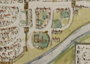
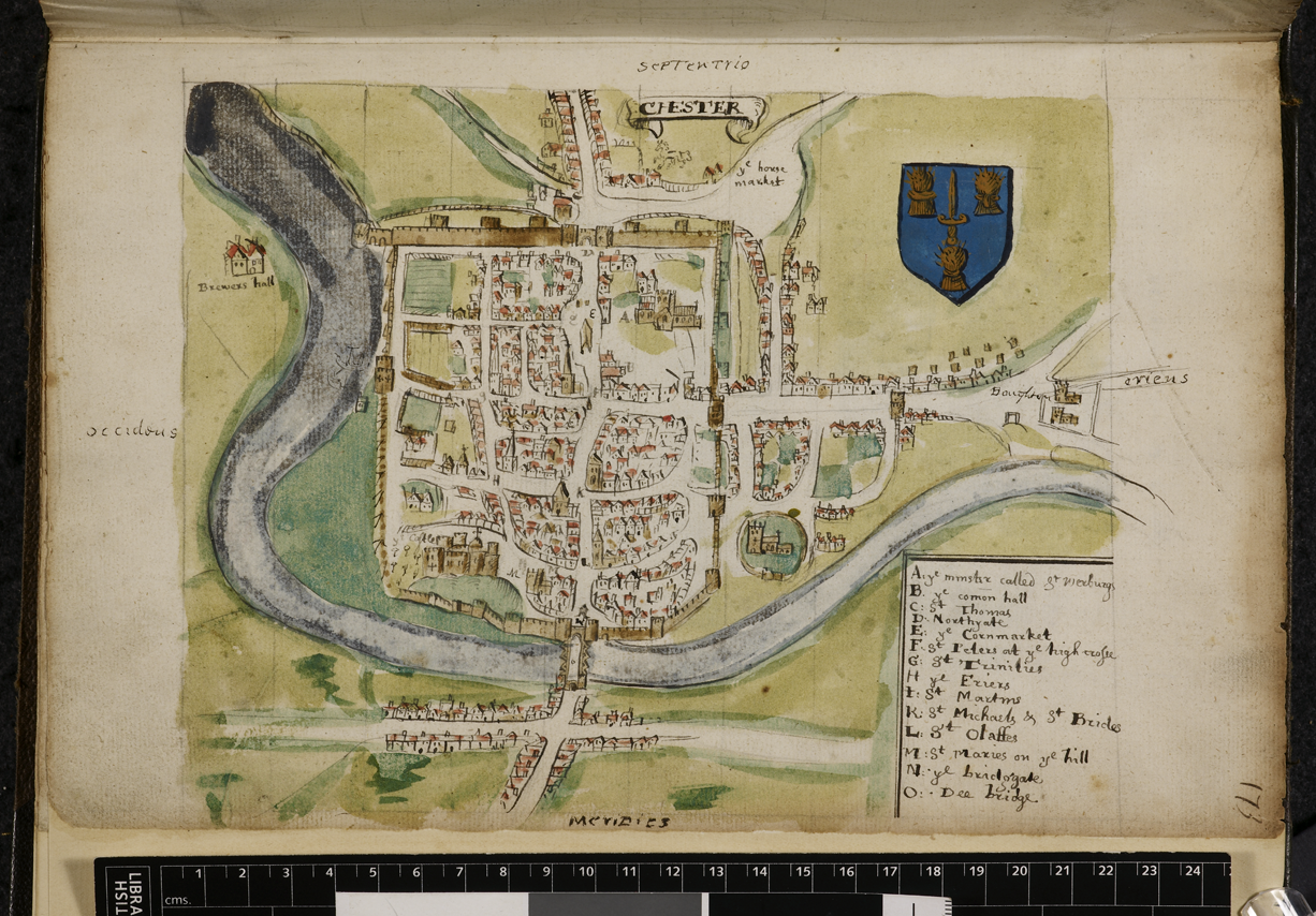
- The Unveiling of Britain: Chester, Harley MS 1046, f. 173 (ca. 1580). Reproduced by permission of the British Library
-
- PLAN Of The City & Castle Of Chester, K.Top. IX, Plate 4. Reproduced by permission of the British Library
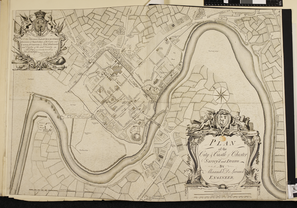
The aim the geographers have is to combine historic maps of Chester to create a detailed and accurate cartographic representation of the city, showing its streets, defences, key buildings, as well as built-up areas existing in c.1500. The changes that have taken place in Chester's urban landscape since the end of the Middle Ages are plain to see here by comparing the Google Earth aerial photograph with historic maps of the city. Trying to reconstruct a map of late-medieval Chester's urban landscape is therefore quite a challenge. Not only does the city's landscape change over time, but clearly so too do the maps themselves change. The earliest map is of c.1580. This takes us back to around the same period that the project's geographers seek to reconstruct. Though helpful in this regard, this early plan is a pictorial representation of the city, not drawn to scale, and omits vital parts of Chester's urban topography.
The three text extracts chosen here by the project's literary historians hint at how Chester's medieval urban and cultural landscape was imaginatively mapped out, textually rather than cartographically, by some medieval writers. At the same time, these extracts also help to expose some of the problems posed by trying to link contemporary descriptions, and their topographies, to Chester's physical urban landscape and its topography as mapped out by the project's geographers. Not only are there practical difficulties here, such as identifying particular locations mentioned in the texts, for example, there are also broader, conceptual issues to address, for example on the validity of trying to link these various 'mappings' of Chester; both the medieval and modern, the metaphorical and literal; and the textual and visual.
In this first extract from Henry Bradshaw’s Life of St Werburge (Book II, lines 400-420), the text focuses on Chester’s status as a centre for religion, administration and trade. These verses also celebrate Chester’s Roman past, its prosperity (indicated by its grand architecture) and the assets of its surrounding countryside. Bradshaw notes Chester’s historical role in the government and control of Wales – but also claims that the city treated both Saxons and Britons (i.e. the Welsh) equally…
This ‘cite of legions’, so called by the Romans,
Nowe is nominat in latine of his proprete
Cestria quasi castria / of honour and pleasance:
Proued by the buyldynge of olde antiquite
In cellers and lowe voultes / and halles of realte
Lyke a comly castell / mighty, stronge and sure,
Eche house like a toure, somtyme of great pleasure.
Vnto the sayd Chestre all northwales subiect were
For reformacion, Iustice and iugement;
Theyr bysshops see also it was many a yere
Enduryng the gouernance of brutes auncient;
To saxons and britons a place indifferent;
The inhabitauntes of it manfull and liberall,
Constant, sad and virtuous / and gentyll continuall.
Of frutes and cornes there is great habundaunce,
Woddes / parkes / forestes / and beestis of venare,
Pastures / feeldes / commons / the cite to auaunce,
Waters / pooles / pondes / of fysshe great plente;
Most swete holsome ayre by the water of dee;
There is great marchaundise / shyps / and wynes strang,
With all thing of pleasure the citezens amonge.
The following short extract (in translation) comes from the Latin text 'In Praise of Chester' ('De Laude Cestrie') written in the late twelfth century by Lucian, a monk at St Werburgh's. Here Lucian sets Chester in its wider geography. He describes the city's peripheral, liminal location on the outer limits of the former Roman Empire and almost the edge of the known world. But he also constructs the city as a powerful centre, looking out on the four points of the compass and the ‘entire globe’.
Chester is chiefly a place to live, because it is built as a city, the placing of which invites consideration. Chester, placed in the westerly parts of Britain, was formerly a shelter for overnighting when legions came from afar, and qualified to guard loyally the limit of the Roman empire, as – I might say – the doorway to Ireland. For, placed facing the northerly bow of Ireland, not so much frequently as continuously on account of travel and diverse trade from suitably equipped boats, it opens a path for the voyages of ships and sailors. And meanwhile, towards the East, Chester holds out a vista, not only of Rome, facing its cathedral and universal church, but also an entire globe for examination, so that a spectacle is displayed for the contemplation of many eyes: the accumulated strength of the fathers, a very long chain of events [Virgil, Æneid i. 641], and whatever is done well on earth by certain persons, in certain places and at certain times is recognised and whatever is badly done is feared. Chester, having four gates corresponding to the four winds – from the East, it looks out upon Asia; from the West, Ireland; from the North, to greater Normandy; from the South, to the place where divine strictness left to the Welsh a narrow corner, on account of their inherent public disagreements. The English once subsumed Wales into England with bitter hatred and divisiveness, against which customs Welsh eyes still glisten as they tearfully read.
Finally, these lines (in translation) from a fifteenth-century Welsh poem by Gruffudd ap Maredudd to the Cross at Chester hint at how medieval writers could imagine Chester - a borderland city - as a place of hybridity and cultural mixing.
A gracious gift came, Trinity Lord of three kingdoms,
To brilliant refined Chester in the fair vale of England,
Made from a type of cedar, the smooth task of cypress,
From branches of pine which entwine together.
To see how the project's teams are grappling with their respective 'mappings' of late-medieval Chester see the blog.